Apr 24, 2017
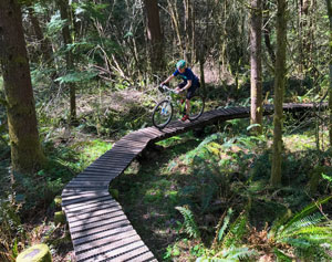 These are the twisting, serpentine, wiggly, doodling, narrow trails—“singletrack” in mountain bike lexicon—that flow and wind and drop, on good soils so it’s not too muddy, always maximizing mileage according to what the topography offers. And while there are plenty of micro ups and downs, you won’t find any long, brutal climbs. One front chainring is all you need. Despite the lack of elevation, however, you’ll get an occasional peek-a-boo view of Mount Rainier. (Sunny days only, sorry.)
The riding out near Black Diamond ranges from advanced-beginner to expert, with most of the trails in a casual intermediate zone. Yes, there are a few wide, straight trails. But most of them will remind you of a kid who’s chucked the straights and only used curved pieces when assembling a train track. In addition to the windies, you’ll hit easy intermediate bridges, log crossings, and dropovers. The advanced riding is well marked, either as a black diamond or as a “freeride” area. Expert steeps, rollovers, ladders, huge jumps, and skinnies can be found, but if high risk isn’t your thing, you can usually find a ride-around to avoid your own personal mayhem.
The thing to remember when mountain biking on the trails out near Black Diamond is that where you are and exactly what the area is called is much less important than the twisting fun you’ll have over the next mile or two.
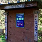 That said, here’s a quick orientation: Henry’s Ridge (known by King County as Maple Ridge Highlands Open Space) is the northernmost area, just southeast of Four Corners, with Black Diamond Natural Area followed by Summit Ridge immediately south. Two primary trails, Route 66 and Master Link, run north-south and connect the many miles of twisty trails in each these three areas. All three are to the east of Highway 169. Lake Sawyer is just southwest of Summit Ridge, on the west side of the highway.
Heads-up: Runners, walkers, and equestrians (on selected trails) also use this system, so ride with care.
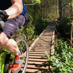 How to get there: Between Four Corners and Black Diamond along Highway 169, you’ll find a few official and semi-official trailheads. One prominent trailhead is just south of Milepost 10 along Highway 169. You can also park near Four Corners (intersection of Highway 169 and Kent-Kangley Road) and ride southeast up Maple Ridge Way. Near the watertower you’ll find various entry points into Maple Ridge Natural Area aka Henry’s Ridge.
Hop over to evergreenmtb.org for more info. Now go put a smile on your face.
John Zilly is a published author, writer, creative director at Milepost 59, and avid mountain biker.[/vc_column_text][/vc_column][/vc_row][vc_row][vc_column][/vc_column][/vc_row]
 Get Ten Trails updates, learn about events and model home openings and provide us with input.
Oakpointe respects your privacy. By completing this form, you acknowledge that you want to receive communications about new home availability at Oakpointe’s master planned community in Black Diamond, WA. Your information may be shared with home builders who build and market new homes in this community. Your information will NOT be shared with any other outside company.
